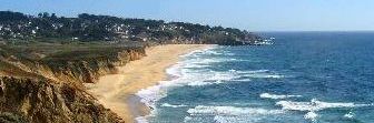
One of the things about living in Montara on the California coast is that the Pacific Ocean really dominates your view, climate, and lifestyle. You don’t really get a sense for how dynamic the experience is until you’ve lived it, unless, you use sensors to record and document your surroundings.
This is where the National Oceanic and Atmospheric Administration’s program called the National Data Buoy Center comes into play. The NDBC program has arrayed buoys all over and has equipped them with instrumentation to record what’s happening around them. In addition, each buoy transmits data back to the center forming a network of sensors used by weather services, fishermen, surfers, ships, etc. These buoys, combined with ship and shore based stations, form a vast network collecting information on air and water temperature, humidity, wave height (frequency and face angle,) air pressure, and wind speed and direction. It’s a pretty comprehensive measurement suite.
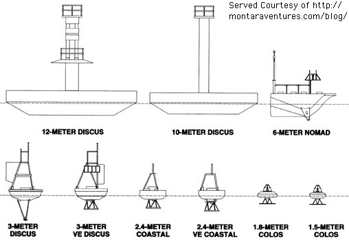
Classes of buoys in use
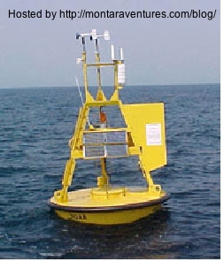
The specific buoy I monitor is #46012, anchored some 38 kilometers SW of San Francisco at GPS coordinates 37°21′ 39″N 122°52’53” W.
Class of buoy representative of #46012
The bottom line: NDBC is a very useful sensor network that is way underappreciated.
Technorati Tags: Buoy | Science | Sensors
« There’s a sucker born every minute
» Security Theater
Coastal Stuff, Innovation
Bully for Buoys
08.17.06 | Comment?


« There’s a sucker born every minute
» Security Theater
Musings from the Coast


comments
recent
- The Art of Being Cheap in Business
- The REAL Fiscal Cliff
- Plan for 2013
- Goodbye Gracie
- Our First Holiday Season as a Retailer
Categories
- Business (252)
- Coastal Stuff (124)
- Commentary (200)
- Energy (256)
- Humor (314)
- Innovation (277)
- Media (144)
- Oddyssea (52)
- Politics (245)
- Religion (80)
- Sports (170)
- Ohio State Football (136)
- Technology & Science (162)
- Travel (106)
Links
- Buckeye View
- Coastsider
- Freedom From Religion Foundation
- Half Moon Bay Buoy
- Half Moon Bay Review
- Information Arbitrage
- Loud Thoughts
- Oddyssea
- Stephen Years dot Com